Geology
Preikestolen Height, Geology and the Crack: Will Pulpit Rock Fall?
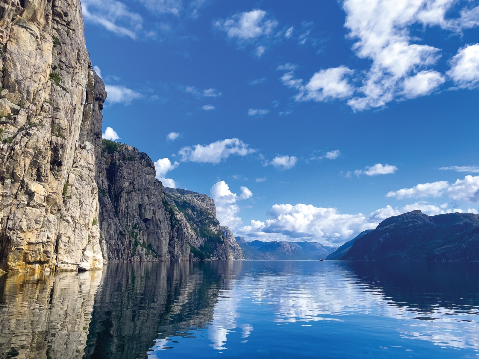
Preikestolen stands 604 metres above the Lysefjord. Its top is an almost flat platform of about 25 by 25 metres that ends in a sheer drop to the water, and because the fjord just below is about 400 metres deep, the fall from the plateau to the fjord floor is close to a kilometre. The whole overhanging block, measured from its top down to where it meets the mountainside, holds about 120,000 cubic metres of rock.
It got that shape from ice and frost working on very old, very hard bedrock. Glaciers deepened the Lysefjord over successive ice ages; when the ice melted about 10,000 years ago, the steep walls lost their support, and frost and rockfalls split the cliff along cracks that meet at right angles. One of those cracks runs across the back of the plateau, half a metre wide, and it has worried people since 1930. A stability study completed in 2018 found that the crack does not run all the way through the rock, and the Geological Survey of Norway (NGU) now describes Preikestolen as standing firm. This article explains the height, the rock, the crack and the evidence.
The short answer
- Height: 604 metres above the Lysefjord, which is sea level here.
- The plateau: almost flat, roughly 25 by 25 metres.
- The drop below the water: the fjord directly below is about 400 metres deep; at its deepest point the Lysefjord reaches 456 metres.
- The rock: hard crystalline bedrock close to a billion years old, which NGU classes as a porphyritic granodiorite.
- How it formed: glaciers carved and over-deepened the fjord; after the ice melted, frost and rock avalanches broke the cliff along right-angled fractures.
- The crack: about half a metre wide and several metres deep, monitored with bolts for years.
- Will it fall? Not in the foreseeable future, on the evidence of the 2018 analysis. NGU’s own sheet adds that it will probably not survive the next ice age.
How high is Preikestolen?
Store norske leksikon, the Norwegian encyclopaedia, and NGU’s geological heritage sheet give the same figure: the cliff juts out 604 metres above the fjord and drops vertically into the sea. Because the Lysefjord is an arm of the sea, that is also its height above sea level.
The height under the water matters too. Go Fjords notes that the fjord directly below the rock is about 400 metres deep, so the total relief from the plateau to the fjord floor is about a kilometre. Elsewhere the Lysefjord is deeper still: NGU gives 456 metres at its deepest point, not counting the loose sediment on the bottom.
If you are planning to walk up, do not confuse the cliff’s height with the climb. The trail starts at the Preikestolen fjellstue, well above the fjord, and the foundation that manages it puts the total ascent of the round trip at around 500 metres, spread over several uphill sections. Our Preikestolen hike guide has the distance and timings.
On the other side of the fjord and further in, the Kjerag massif shows what the same landscape can do at a larger scale: according to Store norske leksikon, it has a vertical drop of nearly 1,000 metres into the fjord. Kjerag is a hike in its own right, covered in our Lysefjord cruise guide.
The plateau and its ledge
Store norske leksikon says the plateau looks almost as if it had been cut out with a knife, and the straight edges are the first thing most people notice in photographs.
The approach is not over open ground. NGU describes a ledge that the path follows onto the plateau from the north-west, along the cliff, and a large crack that separates the platform from the mountain behind it. The crack has its own section below.
The old local name says something about the shape. Before tourists came, people around the fjord called the rock Hyvlatonnå, the “plane’s tooth”, because the square ledge looks like the steel blade of a woodworking plane seen on edge. The name Preikestolen, the “preacher’s chair” or pulpit, came later.
What the rock is made of
Preikestolen is part of a mountain called Neverdalsfjellet. NGU describes its bedrock as true basement rock: a resistant porphyritic granodiorite, which means a granite-like rock with larger crystals set in a finer-grained mass. It is very old, close to a billion years, and geologists assign it to the Sveconorwegian period, named after a mountain-building event of the same age.
The 2018 stability study described the rock in slightly different words. Its laboratory analyses found two solid rock types, coarse-grained granite and gneiss, and tests on samples confirmed that the rock is strong. The two descriptions are not in conflict so much as at different levels of detail: both point to hard, crystalline basement rock, which NGU calls resistant. That strength is one reason the cliff can stand so sheer.
The fjord’s name comes from the same pale rock. Store norske leksikon traces Lysefjorden to the Old Norse Lýsir, probably from the word for “light”, and says it refers to the white-scoured rock along the fjord’s sides.
Before the ice: a valley on a fracture line
The Lysefjord was not dug from nothing. NGU suggests there may have been a valley here before the fjord formed, following a large east-west fracture zone in the bedrock. Preikestolen 365, the visitor site of the foundation that manages the trail, describes the starting point as a river valley cut by streams and rivers into an old plain landscape a few million years ago.
You can still see traces of that older landscape. From the top of the fjord’s sides, a broad, fairly level surface continues on both sides of the fjord. Geologists call it the paleic surface, an ancient upland plain that records what the land looked like before the ice ages carved into it. Standing on Preikestolen and looking across, the plateau-like hills on the far side are part of that old surface.
How glaciers dug the Lysefjord
Over a series of ice ages spanning a period of 1-2 million years, moving glaciers carved the valley into a deep U-shape. NGU describes the Lysefjord as a glacier-eroded, over-deepened valley: the ice dug its floor far below the level of its mouth, which is why the fjord is so much deeper in the middle than at the entrance.
The figures make the point:
- Length: 42 km, running north-east from Høgsfjorden, east of Stavanger.
- Deepest point: 456 metres, not counting the sediment on the floor.
- The threshold at the mouth: under the Lysefjord bridge near Forsand, a smaller sill lies at about 90 metres.
- The outer barrier: at the very end towards Høgsfjorden, a moraine ridge keeps the minimum depth to about 19 metres.
Moraines are the rock and gravel that glaciers push ahead of them and drop as they retreat. Store norske leksikon describes a large moraine at the mouth of the fjord, laid down as the ice withdrew after the last ice age, and the village of Forsand stands there. When the ice melted, rising sea levels eventually broke through the end moraine and flooded the deep basin behind it, turning a glacial valley into a fjord.
From the plateau you can see some of the glaciers’ other leftovers. Looking up the fjord, Lysebotn lies about 30 km away at its head, with large glaciofluvial deposits, the sand and gravel laid down by meltwater.
Why the north wall is so steep
The Lysefjord is not symmetrical, and Preikestolen exists partly because of that. With every ice age, NGU explains, the ice cut into both sides of the fjord, making them steeper and higher each time. But the structure of the bedrock steered the result. In the outer half of the fjord the structures in the bedrock dip towards the north. On the south side the valley wall slopes down towards the water with those structures, giving gentler slopes. On the north side the same structures are cut off, leaving much steeper relief.
That north side is where Preikestolen stands. Rockfalls and rock avalanches then gave it its present form, carving the cliff back along the weaknesses in the rock until the square block was left jutting out.
How the block got its square shape
The straight edges are not a coincidence. Like the rest of Rogaland’s basement rock, the landscape around Preikestolen is crossed by large fractures and fault sets that run roughly at right angles to each other. NGU says those fractures are part of the reason the plateau broke up into its cubic shape.
The end of the last ice age set the process going. Store norske leksikon points to the fracture pattern visible from above: pressure-release joints, which formed when the glacier lying in the fjord basin melted more than 10,000 years ago and the enormous weight of the ice was removed. Without the ice, the mountains in the fjord lost their support and became unstable. According to the Preikestolen 365 account, the three sides of the formation were split off as three large cracks gave way, and the rock avalanches that followed left Preikestolen in its current form.
Go Fjords tells a slightly different version of the same story, with the glacier still present: water from the glacier froze in the crevices of the mountain and broke off large, angular blocks, which the ice then carried away, giving the plateau its angular shape. Both accounts describe the same forces, ice, frost and fractures, acting at the end of the last ice age.
Frost is still at work
The forces that shaped Preikestolen have not stopped. NGU explains the freeze-thaw cycle simply: water finds its way into cracks in the rock, expands when it freezes, and presses on the rock around it. Over time that makes the rock unstable, and blocks can fall from the mountainsides. Large scree slopes along the fjord record such events, and both rockslides and snow avalanches happen every year in the Lysefjord.
The crack across the plateau
Anyone who walks to the back of the plateau sees it: a crack about half a metre wide and several metres deep, running across the rock shelf. According to a 2017 report in The Local, based on Stavanger Aftenblad, it had been a cause for concern since 1930.
Geologists installed bolts on both sides of the crack to measure any widening. In May 2017 the measurements indicated that the gap had widened by 2-3 millimetres, the first recorded change in 22 years. The Local’s headline said geologists feared the rock could collapse, and the story travelled widely. NGU’s own response was cautious. A researcher there said earlier measurements of the crack had proved inaccurate and that NGU assumed Preikestolen had not moved lately, but that it would now study the crack properly.
The reason for the attention is not the hikers on the plateau so much as the fjord below. NGU said it was particularly concerned with mountains standing above fjords, where a collapse could set off tidal waves. Norway knows that danger well: in 1934 a large rockslide into the Tafjord, further north in western Norway, set off a tsunami that killed people living along the shore. A block falling into an inhabited fjord is the scenario that monitoring is designed to rule out.
The 2017 to 2018 stability study
The work on Preikestolen was part of a wider effort. NGU set out to map a total of 33 unstable rock areas in Rogaland, and one result was a master’s thesis by Katrine Mo at the Norwegian University of Science and Technology (NTNU), titled “Stability Analysis of Preikestolen”.
The study combined three ways of building a 3D picture of the cliff, as NGU described them to Teknisk Ukeblad in 2017:
- Helicopter photogrammetry: overlapping photographs taken from a helicopter with a very high-resolution camera of around 40 megapixels.
- Drone photogrammetry: images from a drone, which can fly closer to the rock than a helicopter, at a lower resolution.
- Ground-based laser scanning (LiDAR): measurements taken from the opposite side of the fjord and from the side.
Rock samples went to the laboratory for uniaxial and triaxial compression tests, in which cylinders of rock are loaded until they break, to measure how strong the rock is. Mo then combined the structural measurements with the 3D models in a stability assessment, and presented her results at Geofaredagen in Lillestrøm on 1 November 2018.
What the study found
The headline finding, as reported by forskning.no in November 2018, is that the crack does not run all the way through the rock. That matters because a block can only slide out along a continuous plane of weakness. With no through-going crack, there is no sliding plane along which Preikestolen could fall. Mo went further: even if the crack were eventually to open through the rock, her results showed the safety margin would still be high. A short abstract of the work, listed on NGU’s heritage sheet, concludes that Preikestolen consists of solid rock types and has no cracks running all the way through.
NGU’s sheet adds a geometric point that is easy to see in photographs taken from the south. The big crack dips in towards the north, away from the cliff face. In NGU’s words, the crack leans the wrong way, and Preikestolen stands like a pedestal in the mountainside. The Preikestolen Foundation summarises the same picture: geologists have taken regular measurements since the 1990s, and they show that the crack does not run all the way through and is not widening.
The study had limits, and Mo was open about them. She did not include factors such as earthquakes, water and ice, and suggested that others look into them, perhaps in a further thesis.
Will Preikestolen ever fall?
Eventually, yes. Nothing in a landscape still being worked by frost is permanent, and NGU says plainly that Preikestolen will probably not survive the next ice age. On a human timescale, though, the evidence points the other way: solid rock, no through-going crack, and a fracture that leans away from the drop.
Local tradition has its own answer. A legend retold by the trail’s management says Preikestolen will fall into the sea on the day seven brothers marry seven sisters, when the wedding party rows through the fjord on its way to church. Geologists would put it less romantically, but the conclusion is similar: not soon.
The real hazard on Preikestolen is not the rock giving way but people near an unfenced edge. Our article on Preikestolen deaths and safety looks at the accidents on record and how they happened.
Reading the geology on a visit
You do not need to be a geologist to see most of this on the day. A few things to look for:
- At the trailhead: the parking area is built on a glacial moraine, and big boulders dropped by the ice lie beside the first hills of the trail.
- On the plateau: the crack at the back, the straight right-angled edges, and the blocky fracture pattern in the rock around you.
- Looking up the fjord: Lysebotn at the head of the fjord, and the steep north wall against the gentler southern slopes.
- Looking across: the broad, level skyline of the paleic surface on both sides of the fjord.
- From the water: a Lysefjord cruise shows the cliff from below, which is the best way to appreciate the 604 metres. Our Lysefjord cruise guide compares the boat options, and our tours page lists the trips we link to.
Our guide to getting to Preikestolen covers the bus, the drive and parking. Whatever you go to see, stay well back from the edge: there are no railings, and the view is just as good from a few steps back.
Frequently asked questions
How high is Preikestolen?
Preikestolen rises 604 metres above the Lysefjord, which is sea level at this point. The fjord directly below is about 400 metres deep, so the drop from the plateau to the fjord floor is about a kilometre.
Is the crack in Preikestolen getting bigger?
Bolts across the crack showed a widening of 2-3 millimetres in May 2017, the first recorded change in 22 years, but NGU said earlier measurements had proved inaccurate. The stability study that followed found that the crack does not run all the way through the rock, and the trail’s management says it is not widening.
Will Preikestolen fall into the fjord?
Not in the foreseeable future, according to the 2018 stability analysis and NGU, which says the crack leans the wrong way and the rock stands like a pedestal in the mountainside. Over geological time it will go: NGU expects it will probably not survive the next ice age.
What rock is Preikestolen made of?
NGU classes the bedrock as a resistant porphyritic granodiorite, close to a billion years old. The 2018 study’s laboratory tests described the rock as coarse-grained granite and gneiss; either way, it is hard crystalline basement rock.
How was Preikestolen formed?
Glaciers deepened the Lysefjord over successive ice ages. When the ice melted about 10,000 years ago, the steep walls lost their support, and frost, right-angled fractures and rock avalanches split the cliff into its square shape.